


My Activity Tracking
100
mi
My target 100 mi
I'm taking on the 100 Miles Challenge this year to support Social Bite
I'm taking on the 100 Miles Challenge this year to support Social Bite break the cycle of homelessness, completing 100 miles throughout September and finishing on World Homeless Day on October 10th. This challenge will raise vital funds to expand the innovative work of Social Bite in providing homes, jobs, and food. Social Bite believes everyone deserves a safe place to call home, that a job can be truly transformative for someone who has experienced homelessness, and that food is one of the most powerful engagement tools to help signpost people to access the support needed. I would be grateful if you could support my fundraising efforts with a donation to this page. Every £20 donation could help Social Bite to provide x4 meals for people experiencing homelessness. Together with your support, we can truly help break the cycle of homelessness.My Achievements

Set up a fundraising page

Updated Profile Pic

Self Donated

Received 10 donations

Reached my distance goal

Smashed it! Reached my fundraising goal
My Updates
Walk 16, Oct 10, 7.9 miles – Social Bite to Social Bite …
Wednesday 14th OctFrom the Social Bite cafe on Sauchiehall Street, down to London Road, to the Pipe Factory in Bain Street and on to the Glasgow women’s library in Landressy Street. Then on to the Tullis Street memorial garden, and Strange Field arts centre in French Street, before crossing the river from Bridgton, and then leaving Glasgow behind to pass Camglen Radio in Rutherglen, before reaching Social Bite's supported housing village in Harriet Gardens.
ShareWalk 15, Oct 8, 4.75 miles – Tunnels to love (or hate): Part two, under the Clyde …
Wednesday 14th OctDown to Dumbarton Road, Whiteinch, Clyde pedestrian tunnel
ShareWalk 14, Oct 7, 6.1 miles – Witch way now …
Wednesday 14th Oct To Abercromby St - the former Witch Loan (lane). ShareWalk 13, Oct 5, 5.41 miles – To find the queen …
Wednesday 14th OctAlong to Pollokshaws Road, following the edge of Queen's Park, to the area of the road junctions dubbed Crossmyloof Corner, though it is a little way from the Crossmyloof neighbourhood itself. Turning left up Langside Avenue, then into the park for a wander, taking in the stone plinth, Camphill House and the Glasshouse. Exiting the park at the monument to the Battle of Langside, I head down Battlefield Road, past the Battlefield Rest to cross over into Prospecthill Road. Passing the New Victoria hospital, I eventually turn left from Prospecthill into Cathcart Road, following past Queen's Drive and on until I turn left up to Queen Mary Avenue. This leads eventually to Langside Road, another left and its junction with the other end of Queens Drive, which I follow to Victoria Road at the main gates of the park. Heading down Victoria Road, I take a left into Allison Street, which crosses over Niddrie Road on the way to returning me to Pollokshaws Road.
ShareWalk 12, Oct 4, 5.3 miles – Tunnels to love (or hate): Part one, the Halloween Pen …
Wednesday 14th Oct From Maryhill Road to Lochburn Road, along past the deco-style flats and the start of the industrial estate, to the opening on the right, going underneath the Forth and Clyde canal, and what's known as The Halloween Pen. Through the pen (not for anyone on their own or with mobility issues due to deep mud and hidden hazards) and up along the fence on to the canal as it crosses the railway, stepping down again to cross the field and on to Hillend Road, in Lambhill. Hillend leads eventually to a right turn onto Balmore Road, following that down toanother right turn where it joins Bilsland Drive. Along Bilsland Drive to just past the community centre on the right, where a path leads down to the allotments. It continues past here, however, and on some way before it opens out on to the Ruchill golf course. After a wander here, we follow the edge of the course – with the tip of the Stockingfiend Bridge as our guide – up to the course exit, at the canal and the bridge. Back down by Lochburn Road to Maryhill Road once again. ShareWalk 11 Oct 2, 9.25 miles – The Mackintosh trail …
Tuesday 13th OctFrom Maryhill Road to Shakespeare Street and the artist and architect’s A-listed Ruchill Church Hall, completed in 1899. Then down to where Maryhill Road joins Garscube Road and his A-listed Queen’s Cross Church, built around the same time, with Toshie’s community cafe just a few yards further along. Following Garscube into town, past Cowcaddens and the Buchanan Street Bus Station to reach Townhead, where Mackintosh was from. The A-listed Martyr’s Public School is in Parson Street, the street where he was born, and nearby just off Kennedy Path is the disappointing circle monument, one of three local landmarks that honour Mackintosh. Back into the city centre and along Sauchiehall Street to the Willow Tearooms at No.219, where the interiors were designed by Mackintosh and his wife Margaret Macdonald for Miss Cranston in 1903. Then down to Mitchell Street, to what is now called The Lighthouse – the A-listed 1895 building for newspaper The Glasgow Herald. A short walk away to Renfield Lane is the building completed in 1901 for the Daily Record newspaper. Then it’s down to the Broomielaw and over the Clyde on the Glasgow Bridge, turning onto Kingston Street and into West Street, heading down to the A-listed Scotland Street School, completed in 1907. Then back over the river, west via Charing Cross and Woodland Road to Hillhead Street and the Hunterian Museum at the University of Glasgow. Here is the Mackintosh House, a reassembled interior from the couple’s home nearby at 78 Southpark Street (demolished in the 1960s).
ShareWalk 10 Sep 29, 5.25 miles - Fields and forests …
Tuesday 13th OctAlong Sauchiehall Street – from the Scots, Sauchie Haugh, which means willow meadow – from it's starting point by the Kelvingrove Art Gallery and Museum, all the way into town. A turn left up West Nile Street to Cowcaddens Road, where cattle were once pastured, over Dobbie’s Loan, up Garscube Road, past Raglan Street to St George's Road and along to North Woodside Road leading to South Woodside Road and Kelvinbridge subway station, before reaching Oakfield Avenue and following that to complete the circle at Kelvin Way.
ShareWalk 9, Sep 26, 7.4 miles – Taking to the hills …
Tuesday 13th Oct Across Maryhill Road and on to the top of Ruchill Park and down again, through Hamiltonhill and the edge of Possil to Cowlairs, up into Sighthill Cemetery and on to Petershill Park, then along Petershill Road to Barnhill Station. On again to the Red Road, following it up to turn right and join Broomfield Road, and heading south until it meets Royston Road. Then west through Royston with Roystonhill on the left, crossing above the M8 and on until it meets Baird Street, Kyle Street and Dobbie’s Loan. Then a move away from the traffic, through Cowcaddens, before rejoining the end of Dobbie's Loan to turn right and head up under the motorway this time, on to Garscube Road and back up to Maryhill Road, to complete the circle. ShareWalk 8, Sept 23, 6.15 miles – Taking the High road …
Tuesday 13th OctUp High Street to Havannah Street, down and round the corner of Hunter Street, up Barrack Street (past Wellpark) to Tennent Caledonian Breweries on Duke Street. Then up John Knox Street past the Ladywell, onto Castle Street at Cathedral Square, past Wishart Street, the Necropolis and the William Wallace monument on the right and past Provand’s Lordship. Up Castle street to the Royal Infirmary, along Cathedral Street, along the edge of the campus of the University of Strathclyde, with Rottenrow Gardens but down to the left. Up North Hanover Street, past the Buchanan Galleries and Buchanan Bus Station to Cowcaddens Road and Glasgow Caledonian University. Heading west again, the Theatre Royal is to my left and the Piping Centre on my right, and on to the Children’s Dispensary on West Graham Street. Then a turn left up Dalhousie Street and right along Hill Street, past the late 19th and early 20th centuries premises at 132–138 that housed the Glasgow Cancer Hospital, to the Garnethill Viewpoint.
ShareWalk 7, Sept 22, 4.7 miles – Bridging the gap – Sighthill to Stockingfield …
Tuesday 29th Sep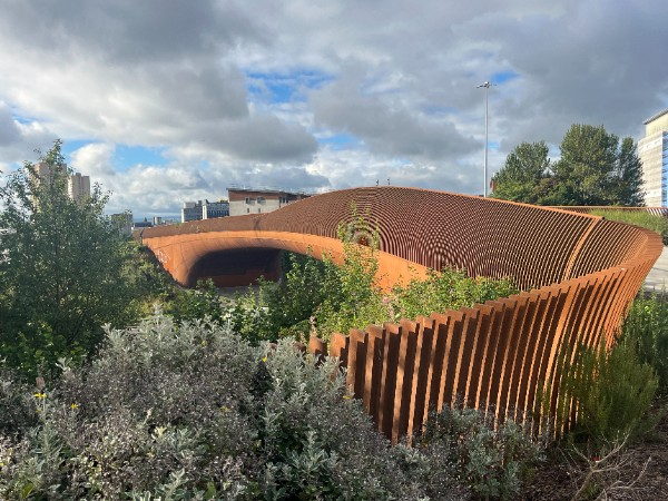
Along Cowcaddens Road and up North Hanover Street, to Kyle Street as it turns into Baird Street – and on to the Rusty Bridge. Or Sighthill Bridge, as it’s more formally known ... Down to the Forth and Clyde canal, along to Applecross quay, past the Firhill Basin and on to the Stockingfield Bridge.
ShareWalk 6, Sept 19, 7.1 miles – C is for castles – Cathcart to Crookston …
Tuesday 29th Sep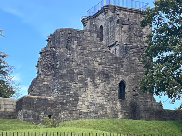
From Old Castle Road to Linn Park and what can still be seen of the Cathcart castle foundations, before heading out to Clarkston Road, Newlands Road and Riverford Road on to Auldhouse Road and Nether Auldhouse Road to the roundabout and on to Barrhead Road. Then on to Brockburn Road – and Crookston Castle.
ShareWalk 5, Sept 16, 6.15 miles – Pushing the boundaries – Braehead …
Tuesday 29th Sep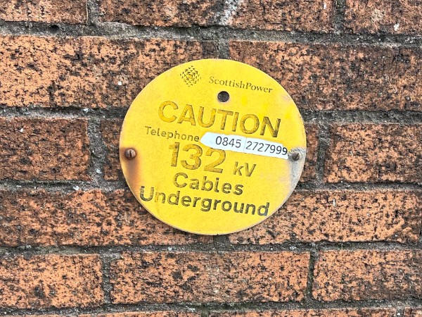
Starting out at the Queen Elizabeth Hospital, I'm walking what used to be the old boundary edge of Glasgow until the area around Braehead shopping centre was transferred to Renfrewshire in 2002.
ShareWalk 4, Sept 12, 7.6 miles – Dear green place, going west …
Tuesday 29th Sep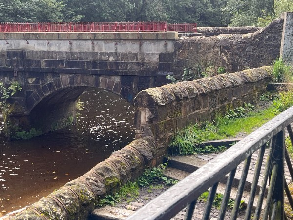
Walk 3, Sept 9, 5.4 miles – Mitchell to Mitchell …
Tuesday 29th Sep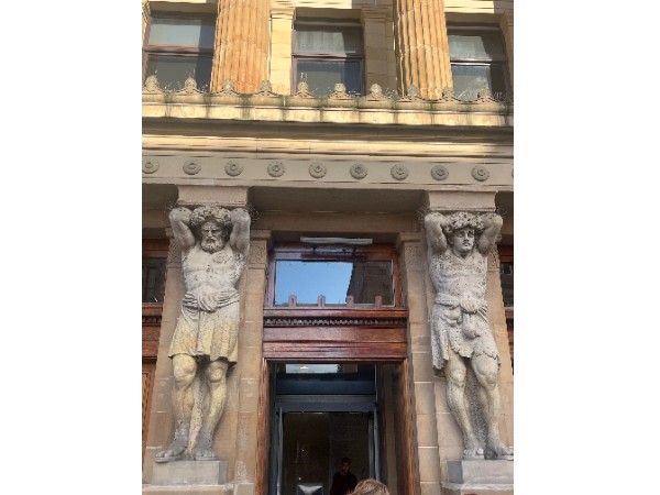
From North Street to the Lighthouse, this walk begins at the Mitchell Library – and the location of St Andrew's Halls, where a famous suffragette meeting ended in chaos - and heads to the riverside path at the Clyde, up to James Morrison Street, and back via Hutcheson Street, to finish at Mitchell Street.
ShareWalk 2, Sept 5, 5.96 miles – Meteorite that rocked a peaceful place …
Friday 11th Sep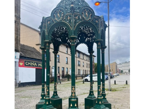
I visited the site of a celestial event – the fall to earth of the High Possil meteorite, the first recorded in Scotland, in 1804. From Bilsland Drive, I turned up Balmore Road and joined the Forth and Clyde canal at Lambhill Stables cafe, then reached the Possil Marsh nature reserve. My return took in Possilpark, site of the former Saracen foundry and former site of Possil Pottery. The name Possil comes from the Cumbric name Possele, place of rest or peaceful place. I then headed along the canal, this time on the Glasgow stretch, past the Claypits nature reserve at Hamiltonhill. See https://ginnyclark.co.uk/100-mile-challenge/ and many thanks to all helping raise money for Social Bite!
ShareWalk 1, Sept 2, 6.08 miles – In footsteps of the ancients …
Friday 4th Sep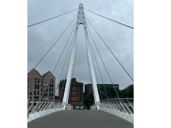
From Partick to Govan, across the footbridge and along to Govan Old Parish Church, returning across the Clyde, around Yorkhill and west along the river to Glasgow Harbour, then back to Partick Cross. The territory of some of this city’s first citizens … Highlight – the amazing hogbacks, Viking burial monuments, at Govan Old Parish Church. Read more about this walk on https://ginnyclark.co.uk/100-mile-challenge/ and many thanks to all helping raise money for Social Bite!
100 miles of Glasgow!
Monday 17th AugI’m taking on Social Bite’s 100-mile challenge …
From September 1 to October 10, I’ll be walking 4-7 miles three times a week. I’ll finish with a route from Social Bite’s Cafe on Glasgow’s Sauchiehall Street to the Social Bite Village in Rutherglen on World Homeless Day, October 10.
My walks will take me all over Glasgow and I will write about each one, telling the stories of some of this city’s buildings and exploring some unusual place-names, on https://ginnyclark.co.uk/
Huge thanks for any support/donations to my fundraising efforts!
Share
Well done, Ginny!